Tutorial
A Crash course in GIS
If you are an expert in GIS, you can skim this section. However, do not completely skip it, as we have included here a number of tips and tricks with GIS, that will save you a lot or time and effort when creating new meshes.
The GIS software we have used in this section is QGIS, because it is open-source and free, thus it is accesible to everyone. However, the concepts are applicable to any GIS suite. Indeed, the two most fundamental datatypes in GIS are vector and raster data, and their correspondence to mesh-generator data-structures was discussed in the Introduction and in [qmesh:2018].
Lets examine an example of each data-structure. Create a folder for the purpose of this example, named GIS_crash_course and inside that place the following two files:
- The filtered and subsampled GEBCO global bathymetry, which you can download from `figshare <>`_.
This is an example of a raster file, where the global bathymetry and topography is represented as data over a regular grid: a number of points along the two geodetic coordinates, longitude and latitude define “pixels” and values attached to each of these points give the value of the elevation at that point.
- The global 0-meter elevation contour, which you can download from `figshare <>`_.
This is an example of a vector file, where a sequence of points defines a line.
Place both files inside the GIS_crash_course folder, and open QGIS. You should have a window similar to Fig. 2, below.
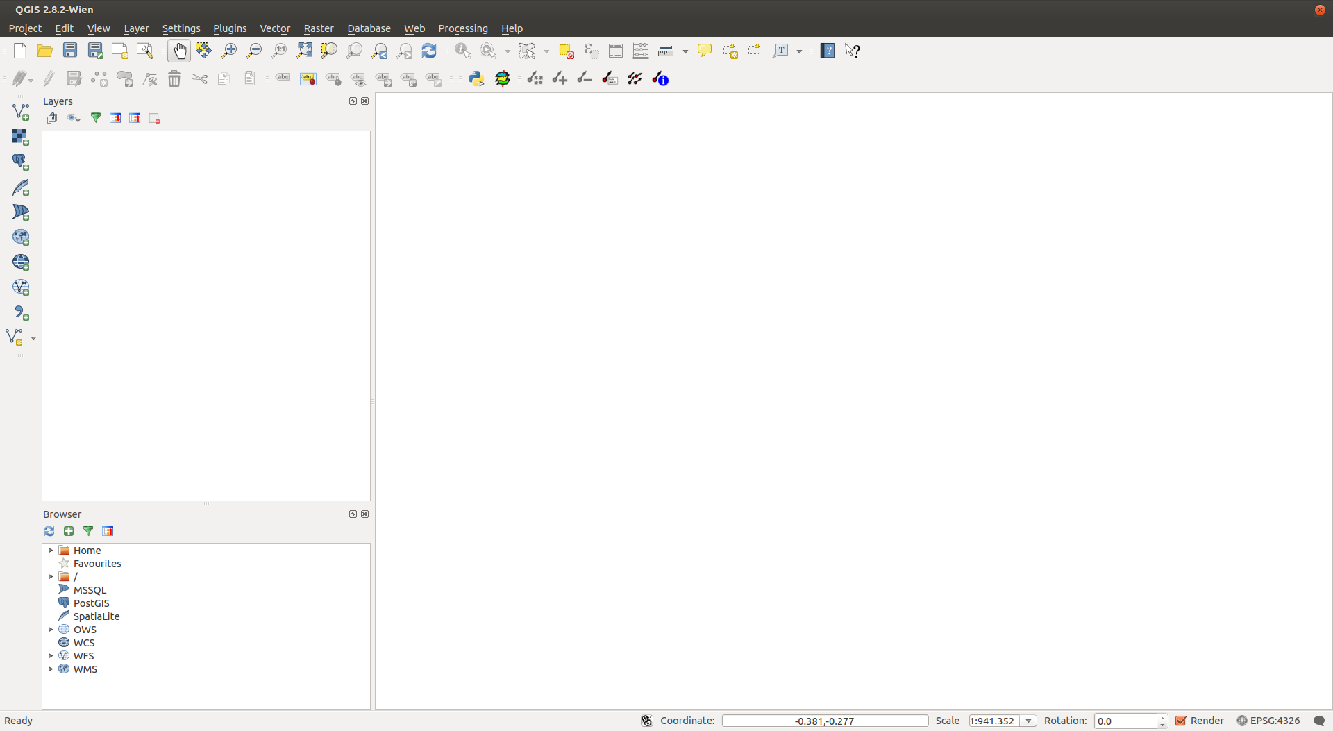
Fig. 2 The Qgis Window.
Lets examine the major areas and tools highlighted in figure Fig. 2, starting with the canvas, and layers windows.
Each vector or raster file is represented in GIS as a separate layer.
The purpose of the canvas is to overlay all layers, and facilitate contextual comparison and editing of the layers.
Lets add the files we downloaded to see how the canvas and layers windows change.
You can add the bathymetry via the Add Raster Layer button, also highlighted in Fig. 2.